Dubai Metro Blue Line Triggers Mirdif Traffic Changes in 2025
Dubai’s Roads and Transport Authority (RTA) has rolled out temporary traffic diversions in Mirdif, aligning with the groundbreaking construction of the Dubai Metro Blue Line, a game-changing addition to the city’s public transport network. This ambitious 30-kilometer metro line is set to revolutionize urban mobility, connecting over one million residents by 2040 and supporting Dubai’s 20-minute city vision. With construction underway, motorists in Mirdif are urged to plan their routes carefully to navigate the new traffic arrangements. This article dives into the details of the traffic changes, the Blue Line’s transformative impact, and how UAE residents can stay ahead of the disruptions while embracing Dubai’s sustainable future.
Mirdif Traffic Diversions: What You Need to Know
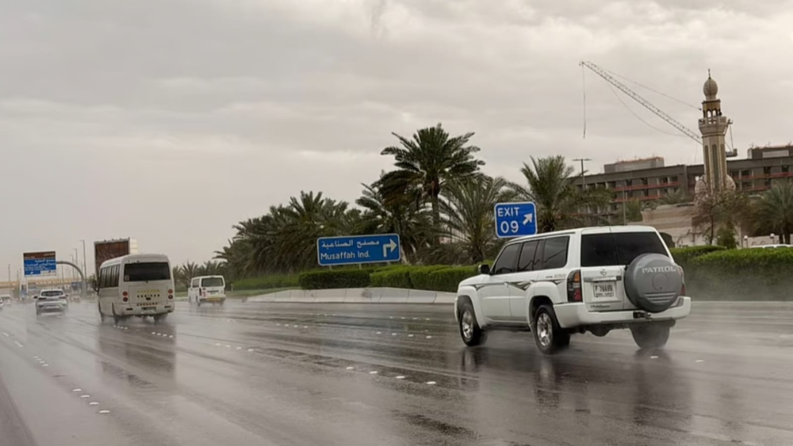
The RTA has introduced temporary road diversions in Mirdif to accommodate the Blue Line’s construction, particularly around the busy 5th Street and 8th Street roundabout near City Centre Mirdif. These changes aim to ensure smooth traffic flow while construction progresses. Here’s a breakdown of the key diversions:
- Roundabout Closure: The intersection linking 5th Street and 8th Street is closed to facilitate metro construction. This closure affects commuters traveling to and from City Centre Mirdif and nearby residential areas.
- Rerouting Traffic:
- Vehicles traveling from 5th Street will be redirected to 8th Street toward City Centre Mirdif.
- Traffic from 8th Street will be rerouted to 5th Street, heading toward Algeria Street.
- Mall Access: A dedicated access road has been created for visitors to reach City Centre Mirdif’s parking areas, ensuring shopping trips remain hassle-free.
- U-Turn Addition: A new U-turn near Ghoroob Square has been introduced to ease traffic flow for residents and commuters coming from City Centre Mirdif Street.
The RTA advises motorists to stay updated on these changes and explore alternative routes to avoid delays. Signage and digital navigation apps like Google Maps or Waze can help drivers adapt to the new traffic patterns. These diversions are temporary but critical to ensuring the timely completion of the Dubai Metro Blue Line, a cornerstone of the city’s sustainable mobility goals.
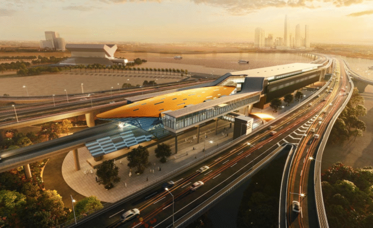
The Dubai Metro Blue Line: A Vision for 2040
The Dubai Metro Blue Line is more than just a transit project—it’s a pivotal component of the Dubai 2040 Urban Master Plan and the Dubai Economic Agenda D33. Designed to enhance urban connectivity, reduce traffic congestion, and promote sustainable transport, the Blue Line will serve approximately one million residents across nine high-density districts. By integrating with the existing Red Line and Green Line, this 30-kilometer corridor will create a seamless public transport ecosystem, making Dubai a global leader in smart mobility.
Key Districts Served by the Blue Line
The Blue Line will connect nine vibrant districts, catering to residential, commercial, and academic hubs:
- Dubai Creek Harbour: A waterfront destination blending luxury living with cultural attractions.
- Dubai Festival City: A bustling hub for shopping, dining, and entertainment.
- Ras Al Khor Industrial Area: A key industrial zone supporting Dubai’s economic growth.
- International City (Phases 1, 2, and 3): A diverse, affordable residential community.
- Dubai Silicon Oasis: A technology and innovation hub.
- Academic City: Home to leading universities and educational institutions.
- Al Warqa: A family-friendly residential area.
- Mirdif: A popular suburban neighborhood with a mix of villas and apartments.
- Al Rashidiya: A well-established community close to Dubai International Airport.
Route and Station Details
The Blue Line spans 30 kilometers and features 14 stations, divided into two main sections:
- Creek Interchange to Academic City (21 km): This section passes through Dubai Festival City, Dubai Creek Harbour, Ras Al Khor, and International City (Phases 1, 2, and 3). It includes an underground interchange at International City 1, ensuring seamless transfers.
- International City to Academic City: The line extends to Dubai Silicon Oasis and Academic City, connecting students, professionals, and residents to key educational and tech hubs.
The Blue Line integrates with the existing metro network at:
- Creek Interchange Station (connecting to the Green Line in Al Jaddaf).
- Centrepoint Station (linking to the Red Line).
This interconnected design reduces travel time, eases traffic congestion, and enhances accessibility across Dubai’s urban landscape.
Why the Blue Line Matters
The Dubai Metro Blue Line is a cornerstone of Dubai’s 20-minute city vision, where 80% of daily needs—work, education, healthcare, and leisure—are accessible within 20 minutes via public transport. By 2040, the line is expected to:
- Serve one million residents, supporting Dubai’s growing population.
- Reduce reliance on private vehicles, cutting carbon emissions and promoting sustainability.
- Alleviate pressure on major roads like Sheikh Mohammed Bin Zayed Road and Al Khail Road.
- Boost connectivity to academic and tech hubs, fostering innovation and economic growth.
The project aligns with the Dubai Economic Agenda D33, which aims to double the city’s economy by 2033 through smart infrastructure and sustainable development. For UAE residents, the Blue Line promises shorter commutes, lower transport costs, and a greener urban future.
Navigating Mirdif During Construction
While the Blue Line’s benefits are long-term, the immediate impact of construction requires UAE residents to adapt. The Mirdif traffic diversions are designed to minimize disruption, but commuters should plan ahead:
- Check RTA Updates: Follow the RTA’s official website (www.rta.ae) or social media channels for real-time updates on road closures and diversions.
- Use Navigation Apps: Apps like Google Maps, Waze, or the RTA’s S’hail app provide live traffic data and alternative routes.
- Plan Extra Time: Allow an additional 15–30 minutes for commutes through Mirdif, especially during peak hours (7–9 AM and 5–8 PM).
- Explore Public Transport: Use existing Dubai Metro lines (Red and Green) or RTA buses to bypass road congestion.
For City Centre Mirdif visitors, the new access road ensures parking remains accessible. Residents near Ghoroob Square can use the U-turn to navigate smoothly. These measures reflect the RTA’s commitment to balancing construction needs with commuter convenience.
Tips for UAE Residents and Visitors
To make the most of your commute during the Blue Line construction:
- Stay Informed: Subscribe to RTA’s newsletter or follow their X account (@RTA_Dubai) for real-time updates.
- Carpool or Rideshare: Share rides with colleagues or neighbors to reduce road congestion.
- Explore Nearby Areas: Visit alternative shopping destinations like Dubai Festival City or Mushrif Mall if Mirdif traffic becomes challenging.
- Support Sustainability: Embrace public transport options to align with Dubai’s green mobility goals.
The Bigger Picture: Dubai’s Sustainable Future
The Dubai Metro Blue Line is a testament to the UAE’s commitment to smart cities and sustainable urban development. By connecting high-density districts and reducing reliance on private vehicles, the line will transform how residents move, work, and live. The temporary inconveniences in Mirdif are a small price to pay for a project that will shape Dubai’s future for decades.
As construction progresses, UAE residents can look forward to a more connected, efficient, and eco-friendly Dubai. The Blue Line is not just a metro—it’s a step toward a 20-minute city where accessibility and sustainability go hand in hand.


1 Comment
[…] is building one of its biggest transport projects – the Dubai Metro Blue Line. This new metro line will make travel faster, smoother, and easier for residents and visitors. The […]
Comments are closed.